Lee County NC Emergency Services's Fan Box

Saturday, January 30, 2010

6:00 AM Pictures

6:00 AM Update

The roads in the county are completely covered and we are asking people to please stay at home and off the roads. Heavier precipitation will be moving in latter this morning and precipitation is forcasted to
continue until later this afternoon. Winds are starting to pick up and this can and will lead to power outages. At this time no power outages are noted on the maps. We will continue to monitor the storm and send updates out as they are received.


Shane

Friday, January 29, 2010

A few pictures from the office.

A few pictures from the office!


THE SNOW HAS ARRIVED

839 PM EST FRI JAN 29 2010


THE SNOW HAS STARTED IN LEE COUNTY AND IS COMING DOWN AT A STEADY RATE. THE SNOW HAS ACTUALLY ARRIVED ABOUT THREE HOURS EARLY TO OUR SURPRISE. TEMPERATURES AT OUR OFFICE HAVE DROPPED BELOW FREEZING ALREADY AND IS HOLDING AT 29 DEGREES. OUR EOC IS OFFICIALY UP AND RUNNING AND WE WILL MONITOR CONDITIONS AND SEND OUT INFORMATION AS IT COMES AVAILABLE.

BELOW IS THE LATEST UPDATE FROM THE NATIONAL WEATHER SERVICE ON CONDITIONS.

BE SAFE...BE PREPAPARED,
SHANE


839 PM EST FRI JAN 29 2010


...SNOW CONTINUED TO SPREAD OVER MUCH OF CENTRAL NORTH CAROLINA...

AT 830 PM...SNOW WAS HEAVIEST IN A BAND THAT EXTENDED FROM JUST WEST OF ROCKY MOUNT...THROUGH RALEIGH...THEN WEST THROUGH THE LEXINGTON AND ALBEMARLE AREAS. TO THE NORTH ALONG THE VIRGINIA BORDER...SNOW WAS LIGHT. ACROSS THE SANDHILLS AND SOUTHERN COASTAL PLAIN...SCATTERED PATCHES OF SNOW WERE OCCURRING. WHERE THE SNOW HAD BEEN HEAVIER...AMOUNTS RANGED FROM A DUSTING TO AROUND 2 INCHES IN SPOTS. SOME OF THE LOCATIONS WITH AMOUNTS NEAR 2 INCHES INCLUDED HILLSBOROUGH...TYRO IN DAVIDSON COUNTY...AND DURHAM.

THROUGH 930 PM...THE HEAVIEST PRECIPITATION WILL CONTINUE TO BE ALONG AND NEAR HIGHWAY 64...WHERE THERE WILL BE PERIODS OF MODERATE TO HEAVY SNOW. AS THE SNOW FALLS...TEMPERATURES QUICKLY FALL BELOW FREEZING. THIS WILL RESULT IN ICY CONDITIONS DEVELOPING ON ANY UNTREATED AREA ROADS AND WALKWAYS. AS THE SNOW MOVES IN AND STARTS TO ACCUMULATE...AVOID TRAVEL. IF YOU ABSOLUTELY MUST TRAVEL...DRIVE SLOW. DRIVING AT EVEN POSTED SPEEDS IS EXTREMELY DANGEROUS WHEN SNOW AND ICE ARE ON THE ROAD.

Friday Morning Winter Storm Update


It appears that Lee County is the dividing line for snow and ice. 6-10 inches of wet snow on the north side of the county with 2-6 inches of snow on the south side. They are still predicting up to a half inch of ice on top of the snow. Precipitation should begin around 11:00 PM tonight and continue thru lunch tomorrow followed by windy conditions with gust as high as 25 MPH. I will send additional information after lunch and the next update from the weather service will be around 3:30 this afternoon. We will open our EOC at 9:00 PM tonight.

Thursday, January 28, 2010

Winter Storm Warning

Winter Storm Warning


Lee (North Carolina)
URGENT - WINTER WEATHER MESSAGE
NATIONAL WEATHER SERVICE RALEIGH NC
414 PM EST THU JAN 28 2010
A WINTER STORM WILL PRODUCE FROZEN PRECIPITATION ACROSS MOST OF CENTRAL NORTH CAROLINA FRIDAY EVENING THROUGH SATURDAY.
414 PM EST THU JAN 28 2010

...WINTER STORM WARNING IN EFFECT FROM 6 PM FRIDAY TO MIDNIGHT EST SATURDAY NIGHT...THE NATIONAL WEATHER SERVICE IN RALEIGH HAS ISSUED A WINTER STORM WARNING WHICH IS IN EFFECT FROM 6 PM FRIDAY TO MIDNIGHT EST
SATURDAY NIGHT. THE WINTER STORM WATCH IS NO LONGER IN EFFECT.
BASIS...A COLD FRONT WILL PUSH SOUTH THROUGH CENTRAL NORTH CAROLINA TONIGHT. DRAMATICALLY COLDER AIR BEHIND THE FRONT WILL SURGE INTO CENTRAL NORTH CAROLINA ON FRIDAY. A LOW PRESSURE SYSTEM WILL DEVELOP ACROSS THE LOWER MISSISSIPPI RIVER VALLEY ON FRIDAY...MOVE EAST
ACROSS THE DEEP SOUTH FRIDAY NIGHT...THEN EAST NORTHEAST OFF THE CAROLINA COAST ON SATURDAY.
PRECIPITATION TYPES AND ACCUMULATION...DAMAGING ICE ACCUMULATIONS OF A QUARTER TO A HALF INCH ARE EXPECTED...IN ADDITION TO LIGHT SNOW AND SLEET ACCUMULATIONS. PRECIPITATION IS EXPECTED TO BEGIN AS A
BRIEF MIX OF RAIN AND SNOW FRIDAY NIGHT BEFORE QUICKLY TRANSITIONING TO SLEET AND FREEZING RAIN EARLY SATURDAY MORNING.


We have completed a situational awareness briefing with Emergency Personnel from across the county.


We will continue to provide pertinent information as it becomes available. I have included the latest warning issued by the National Weather Service below.

Our lasting briefing calls for sleet and freezing rain to start late tomorrow evening then change over to snow after midnight. We may see the precipitation switch between sleet, freezing rain and snow several times. We could see accumulations of 2 to 6 inches of snow and up to 3/8 inch of ice. This will be followed by extremely cold temperatures and winds blowing from 10-15 MPH gusting to 25 MPH. Keep in mind any variation of the storm track could have detrimental effect on the storm totals.

At this time we are still planning a Level 3 activation of our EOC beginning at 19:00 on Friday and our office will remain open as needed. A Level 3 EOC activation is typically a "monitoring" phase. Notification will be made to those county agencies and Emergency Support Functions who would need to take action as part of their everyday responsibilities. The State emergency operation Center will be staffed with Division of Emergency Management staff.

Be safe...Be prepared,
Shane Seagroves
Emergency Services Director

Winter Storm Watch


Winter Storm Watch


Lee (North Carolina)

URGENT - WINTER WEATHER MESSAGE

NATIONAL WEATHER SERVICE RALEIGH NC

1117 AM EST THU JAN 28 2010

...WINTER STORM WATCH IN EFFECT FROM LATE FRIDAY THROUGH SATURDAY AFTERNOON...A WINTER STORM WILL SPREAD WINTRY PRECIPITATION ACROSS MOST OF CENTRAL NORTH CAROLINA LATE FRIDAY THROUGH SATURDAY.


1117 AM EST THU JAN 28 2010

...WINTER STORM WATCH NOW IN EFFECT FROM FRIDAY EVENING THROUGH


SATURDAY EVENING...

THE WINTER STORM WATCH IS NOW IN EFFECT FROM FRIDAY EVENING THROUGH SATURDAY EVENING.


BASIS...A COLD FRONT WILL MOVE SOUTH ACROSS CENTRAL NORTH

CAROLINA LATE TODAY WITH DRAMATICALLY COLDER AIR SURGING INTO CENTRAL NORTH CAROLINA ON FRIDAY. A STORM SYSTEM WILL DEVELOP ACROSS THE NORTHERN GULF OF MEXICO ON FRIDAY AND THEN MOVE EAST-NORTHEAST OFF THE SOUTHEAST COAST ON SATURDAY. PRECIPITATION TYPES AND ACCUMULATION...ALTHOUGH IT IS TOO EARLY TO SPECIFY EXACT AMOUNTS...AT THIS TIME IT APPEARS THAT THERE WILL BE ENOUGH COLD AIR TO SUPPORT SIGNIFICANT WINTRY PRECIPITATION IN THE WATCH AREA. LOCATIONS NEAR THE VIRGINIA BORDER ARE LIKELY TO SEE MAINLY SNOW. FURTHER SOUTH NEAR THE U.S. 64 CORRIDOR...THE PRECIPITATION IS LIKELY TO BE MORE OF A MIX OF SNOW AND SLEET. ACROSS THE SOUTHERN PIEDMONT INTO THE CENTRAL COASTAL PLAIN A MIXTURE OF FREEZING RAIN AN SLEET WILL BE POSSIBLE.


TIMING AND DURATION... PRECIPITATION IS EXPECTED TO OVERSPREAD THE WATCH AREA FROM SOUTHWEST FRIDAY EVENING AND CONTINUE THROUGH SATURDAY. THE HEAVIEST PRECIPITATION IS LIKELY TO FALL FROM MIDNIGHT FRIDAY NIGHT THROUGH MIDDAY SATURDAY.


IMPACTS...WHILE DETAILS ARE STILL DIFFICULT TO PINPOINT AT THIS TIME...THERE IS AN INCREASING POTENTIAL FOR A SIGNIFICANT WINTER STORM ACROSS THE WATCH AREA. ACCUMULATIONS OF SNOW AND ICE ARE EXPECTED TO ADVERSELY IMPACT TRAVEL AND POTENTIALLY RESULT IN DOWNED TREES AND POWERLINES. AFTER THE PRECIPITATION SETS IN FRIDAY EVENING...TEMPERATURES ARE EXPECTED TO REMAIN NEAR OR

BELOW FREEZING THROUGH MIDDAY MONDAY.


A WINTER STORM WATCH IS ISSUED WHEN SEVERE WINTER WEATHER IS POSSIBLE...BUT NOT IMMINENT. AT THE TIME...THERE IS POTENTIAL FOR SIGNIFICANT SNOW AND/OR ICE ACCUMULATIONS.

NOW IS THE TIME TO BE THINKING ABOUT EMERGENCY SUPPLIES...BEFORE WINTER STORM CONDITIONS ARRIVE. STOCK AN EMERGENCY SUPPLY OF FOOD AND WATER PRIOR TO THE ONSET OF A WINTER STORM. ALSO KEEP ON HAND A FLASH LIGHT...BATTERY POWERED RADIO...EXTRA BATTERIES AND A

FIRST AID KIT. THOSE PLANNING TRAVEL ACROSS THE REGION DURING THIS TIME SHOULD CONSIDER ALTERNATE PLANS... AS TRAVEL MAY BECOME DANGEROUS.


Vehicle Accident Steele Bridge Road 1/28/2010


Early Thursday morning there was a single vehicle accident on Steele Bridge Road. The vehicle ran off the road and struck a tree. One person was injured. Northwest Pocket and Tramway Fire Departments responded to the scene. Other responders included Lee County Office of Emergency Services, EMS, Lee County Sheriff's Office, NC State Highway Patrol and Wake Med helicopter.

RadioShack Recalls Knight Hawk Toy Helicopters Due to Fire Hazard

WASHINGTON, D.C. - The U.S. Consumer Product Safety Commission, in cooperation with the firm named below, today announced a voluntary recall of the following products. Consumers should stop using recalled products immediately unless otherwise instructed.

Name of Product: Danbar Knight Hawk Toy Helicopters

For more info on this product follow the link below.
http://www.cpsc.gov/cpscpub/prerel/prhtml10/10121.html

submitted by: Lee County Emergency Services DFM Mike Tatum

How to Survive a Winter Storm Without Power

Surviving winter storms after you lose power can be a challenging event. Depending on the length of time that the power is out, the house can get cold enough to freeze pipes within the house.


During this time, many residents still want to get heat into their house any way possible. Some have a generator with a cord that plugs into the dryer plug. This is dangerous for two reasons: 1) you have two male plugs on the cord – you can be electrocuted touching the contacts on the cord, and 2) you MUST turn off the main breaker to the house so that power will not be delivered back to the power lines, endangering the lives of the Progress Energy line crews.

The biggest danger is to the folks who bring their gas grills, camp stoves, charcoal grills, and other devices with an open flame into their house for heat. Open flame heaters create Carbon Monoxide (CO) during the breakdown of the hydrocarbon fuels. Carbon Monoxide is a colorless, odorless, tasteless gas that will make you sleepy as the concentration increases until you fall asleep and die. There are Carbon Monoxide gas detectors on that market that operate on home AC power as well as DC batteries. These will monitor the CO levels in the house during normal times, and with the battery backup, will monitor the CO levels in the house when AC power is off. If you MUST use an open flame heater to heat your house, be sure to have a CO monitor and open a window once in a while to allow fresh air into the house.

Everyone who normally heats with hydrocarbon fuel (Gas or Oil) needs to have a CO monitor in their house in case their heating system malfunctions.

Submitted by Roger Millikin – Emergency Management Technical Support

Tuesday, January 26, 2010

Training Update

TR: General Helicopter Transport

When: 01/30/2010      0900-1600

Credit Hours: 6 

Where: ESTC-CCCC Rm 120 

Instructor: D. Adams

Credit appies to General Techincal Rescue Requirements

Monday, January 25, 2010

Preparation for the “Normal” Disaster

For Disaster Preparation, the Federal Emergency Management Agency (FEMA) recommends that everyone have a three day supply of liquid (water, other drinks), non perishable food items, medications, and other special items that you may need. Also needed is some cash in case the power is off for an extended period of time, and stores are open using manual cash transactions. If you use canned goods, remember to have a manual can opener. Other preparedness items are discussed on the websites identified below.


Normal disasters for Lee County include localized flooding, windstorms, tornados, tropical storms and category 1 hurricanes, snow or ice storms, and forest fires. These disasters occur on a regular basis, and will impact normal life in the area. Evacuations could be required, people could be isolated for several days, and could be without power for a week or longer.

Most people use Hurricane Fran as Lee County’s benchmark, but Fran was only a Tropical Storm as it crossed the County.

Everyone should be prepared for these disasters as most will disrupt normal life without warning.

Preparedness information can be found on the Lee County website at www.leecountync.gov/Departments/EmergencyManagement/EmergencyPreparednessInformationandDownloads/tabid/143/Default.aspx.

Additional preparedness information can be found at www.ready.gov/america/local/nc.html, www.ready.gov/america, or at www.fema.gov/areyouready .

Submitted by: Roger Millikin, Emergency Management Technical Support

Gehl Foods Recalls Nacho Cheese and Chili Sauce Dispensers Due to Fire and Burn Hazards

WASHINGTON, D.C. - The U.S. Consumer Product Safety Commission, in cooperation with the firm named below, today announced a voluntary recall of the following consumer product. Consumers should stop using recalled products immediately unless otherwise instructed.
Name of Product: Gehl’s HOT TOP2 Nacho Cheese and Chili Sauce Dispensers

For more information click on the link below.

submitted by: Lee County Emergency Services DFM Mike Tatum

GAS LEAK ON COLON ROAD


On Monday, 1/25/2010, Sanford and Northview Fire Departments responded to a gas leak on Colon Road. Upon arrival, it was discovered that a company was doing demolition work at the General Shale Brick Plant and had broke a 2 inch gas line. Other units responding to the call included Sanford Police, EMS unit, Lee County Emergency Services, and NC Public Gas. Twenty-nine people responded to the call. Areas around the leak were monitored for gas levels. Pentair Pools was evacuated while the leak was stopped. Trains were stopped from passing through the area. The leak was shut off after about 45 minutes. There were no injuries related to this accident. 

Sunday, January 24, 2010

URGENT WEATHER MESSAGE-WIND ADVISORY TONIGHT

Wind Advisory


URGENT - WEATHER MESSAGE

NATIONAL WEATHER SERVICE RALEIGH NC

935 PM EST SUN JAN 24 2010


...GUSTY SOUTHERLY WINDS EXPECTED OVERNIGHT...
GUSTY SOUTHERLY WINDS COMBINED WITH HEAVY RAIN AND SOGGY GROUND
CONDITIONS WILL LEAD TO DOWNED TREES OVERNIGHT ACROSS CENTRAL
NORTH CAROLINA.

935 PM EST SUN JAN 24 2010
WIND ADVISORY IN EFFECT UNTIL 9 AM EST MONDAY...
THE NATIONAL WEATHER SERVICE IN RALEIGH HAS ISSUED A WIND
ADVISORY...WHICH IS IN EFFECT UNTIL 9 AM EST MONDAY.

SUSTAINED SOUTHERLY WINDS OF 20 TO 30 MPH WITH GUSTS UP TO 45 MPH
ARE EXPECTED OVERNIGHT AHEAD OF A COLD FRONT APPROACHING THE AREA.
THESE GUSTY WINDS...COMBINED WITH HEAVY RAINFALL AND SOGGY GROUND
CONDITIONS...WILL LIKELY LEAD TO DOWNED TREES ACROSS THE AREA.

PRECAUTIONARY/PREPAREDNESS ACTIONS...
A WIND ADVISORY MEANS THAT SUSTAINED WINDS GREATER THAN 30 MPH...
OR WIND GUSTS GREATER THAN 45 MPH ARE EXPECTED. WINDS THIS STRONG
CAN MAKE DRIVING DIFFICULT...ESPECIALLY FOR HIGH PROFILE VEHICLES.
ADDITIONALLY...DOWNED TREES MAY RESULT IN HAZARDOUS DRIVING
CONDITIONS. MOTORISTS ARE URGED TO SLOW DOWN AND USE EXTRA CAUTION
WHILE DRIVING OVERNIGHT.

FLOOD WATCH...UPDATED


Flash Flood Watch

NATIONAL WEATHER SERVICE RALEIGH NC
922 PM EST SUN JAN 24 2010

...FLASH FLOOD WATCH IN EFFECT TONIGHT THROUGH MONDAY MORNING....DEEP MOISTURE WILL BE IN PLACE TONIGHT AS A STRONG SLOW MOVING COLD FRONT PUSHES EASTWARD ACROSS NORTH CAROLINA. WIDESPREAD HEAVY RAINFALL OF ONE TO TWO INCHES IS POSSIBLE AS THE FRONT CROSSES CENTRAL NORTH CAROLINA.
GRANVILLE-VANCE-WARREN-FORSYTH-GUILFORD-ALAMANCE-ORANGE-
DURHAM-FRANKLIN-DAVIDSON-RANDOLPH-CHATHAM-WAKE-STANLY-MONTGOMERY-MOORE-LEE-ANSON-RICHMOND-

INCLUDING THE CITIES OF...ROXBORO...OXFORD...HENDERSON...
WARRENTON...WINSTON-SALEM...GREENSBORO...HIGH POINT...
BURLINGTON...CHAPEL HILL...DURHAM...LOUISBURG...LEXINGTON...
ASHEBORO...PITTSBORO...RALEIGH...ALBEMARLE...TROY...
SOUTHERN PINES...SANFORD...WADESBORO...ROCKINGHAM

922 PM EST SUN JAN 24 2010
...FLASH FLOOD WATCH REMAINS IN EFFECT UNTIL 9 AM EST MONDAY...

THE FLASH FLOOD WATCH CONTINUES FOR
* A PORTION OF CENTRAL NORTH CAROLINA...INCLUDING THE FOLLOWING
AREAS...ALAMANCE...ANSON...CHATHAM...DAVIDSON...DURHAM...
FORSYTH...FRANKLIN...GRANVILLE...GUILFORD...LEE...MONTGOMERY...
MOORE...ORANGE...PERSON...RANDOLPH...RICHMOND...STANLY...
VANCE...WAKE AND WARREN.

* UNTIL 9 AM EST MONDAY
* WIDESPREAD RAINFALL AMOUNTS OF ONE TO TWO INCHES ARE EXPECTED
ACROSS THE PIEDMONT OF NORTH CAROLINA TONIGHT THROUGH MONDAY
MORNING...WITH ISOLATED HIGHER AMOUNTS UP TO 3 INCHES POSSIBLE IN ANY THUNDERSTORMS.
* THESE RAINFALL AMOUNTS ARE LIKELY TO PRODUCE RAPID RISES ON AREA
CREEKS AND STREAMS. IN PARTICULAR...CREEKS THAT TEND TO RISE QUICKLY WITH HEAVY RAIN...INCLUDING CRABTREE CREEK IN THE TRIANGLE AND BUFFALO CREEK IN THE TRIAD...MAY EXPERIENCE FLOODING. HIGH WATER IS ALSO POSSIBLE IN URBAN AND POOR DRAINAGE AREAS. MAINSTEM RIVERS INCLUDING THE HAW ...TAR ..NEUSE
...AND ROCKY RIVER ARE ALSO LIKELY TO SEE SIGNIFICANT RISES OVER THE NEXT FEW DAYS.

PRECAUTIONARY/PREPAREDNESS ACTIONS...
A FLASH FLOOD WATCH MEANS THAT CONDITIONS MAY DEVELOP THAT LEAD TO FLASH FLOODING. FLASH FLOODING IS A VERY DANGEROUS SITUATION. PEOPLE IN THE AREA SHOULD MONITOR LATER FORECASTS... AND BE PREPARED TO TAKE ACTION SHOULD FLASH FLOOD WARNINGS BE ISSUED.

Saturday, January 23, 2010

National Weather Service Flood Watch For Lee County


FLOOD WATCH
NATIONAL WEATHER SERVICE RALEIGH NC
351 PM EST SAT JAN 23 2010

FLASH FLOOD WATCH IN EFFECT FOR SUNDAY EVENING THROUGH MID MORNING MONDAY.

A SLOW MOVING COLD FRONT WILL MOVE INTO WESTERN NORTH CAROLINA
LATE SUNDAY AND PUSH EASTWARD THROUGH SUNDAY NIGHT. WIDESPREAD
MODERATE TO HEAVY RAIN AND A FEW THUNDERSTORMS ARE EXPECTED OVER
CENTRAL NORTH CAROLINA AS THE FRONT MOVES THROUGH.

PERSON-GRANVILLE-VANCE-WARREN-FORSYTH-GUILFORD-ALAMANCE-ORANGE-
DURHAM-FRANKLIN-DAVIDSON-RANDOLPH-CHATHAM-WAKE-STANLY- MONTGOMERY-MOORE-LEE-ANSON-RICHMOND-INCLUDING THE CITIES OF...ROXBORO...OXFORD...HENDERSON...WARRENTON...WINSTON-SALEM...GREENSBORO...HIGH POINT...BURLINGTON...CHAPEL HILL...DURHAM...LOUISBURG...LEXINGTON...ASHEBORO...PITTSBORO...RALEIGH...
ALBEMARLE...TROY...SOUTHERN PINES...SANFORD...WADESBORO...ROCKINGHAM

351 PM EST SAT JAN 23 2010
FLASH FLOOD WATCH IN EFFECT FROM SUNDAY EVENING THROUGH MONDAY
MORNING...

THE NATIONAL WEATHER SERVICE IN RALEIGH HAS ISSUED A * FLASH FLOOD WATCH FOR A PORTION OF CENTRAL NORTH CAROLINA...
INCLUDING THE FOLLOWING AREAS...ALAMANCE...ANSON...CHATHAM...
DAVIDSON...DURHAM...FORSYTH...FRANKLIN...GRANVILLE...
GUILFORD...LEE...MONTGOMERY...MOORE...ORANGE...PERSON...
RANDOLPH...RICHMOND...STANLY...VANCE...WAKE AND WARREN.

* FROM SUNDAY EVENING THROUGH MONDAY MORNING
* A COLD FRONT WILL MOVE INTO WESTERN NORTH CAROLINA LATE SUNDAY AND PUSH SLOWLY EASTWARD THROUGH SUNDAY NIGHT. COPIOUS AMOUNTS OF ATLANTIC AND GULF MOISTURE STREAMING INTO CENTRAL NORTH CAROLINA AHEAD OF THIS FRONT WILL PRODUCE WIDESPREAD RAIN OVER THE WATCH AREA BEGINNING LATE SUNDAY AND LASTING THROUGH DAYBREAK MONDAY. STORM TOTAL RAINFALL AMOUNTS OF TWO TO THREE INCHES ARE EXPECTED... WITH ISOLATED HIGHER TOTALS POSSIBLE.
* THESE RAINFALL AMOUNTS ARE LIKELY TO PRODUCE RAPID RISES ON AREA CREEKS AND STREAMS. IN PARTICULAR... CREEKS THAT TEND TO RISE QUICKLY WITH HEAVY RAIN... INCLUDING CRABTREE CREEK IN THE TRIANGLE... BUFFALO CREEK IN THE TRIAD... AND CROSS CREEK IN FAYETTEVILLE... MAY EXPERIENCE FLOODING. HIGH WATER IS ALSO POSSIBLE IN URBAN AND POOR DRAINAGE AREAS. MAINSTEM RIVERS
INCLUDING THE HAW... TAR... NEUSE... AND ROCKY RIVER ARE ALSO LIKELY TO SEE RISES OVER THE NEXT FEW DAYS.

PRECAUTIONARY/PREPAREDNESS ACTIONS...
 FLASH FLOOD WATCH MEANS THAT CONDITIONS MAY DEVELOP THAT LEAD TO FLASH FLOODING. FLASH FLOODING IS A VERY DANGEROUS SITUATION. PEOPLE IN THE AREA SHOULD MONITOR LATER FORECASTS... AND BE PREPARED TO TAKE ACTION SHOULD FLASH FLOOD WARNINGS BE ISSUED.

submitted by LC Emergency Services Director Shane Seagroves

Friday, January 22, 2010

Backpack Blowers Recalled by Homelite Due to Fire Hazard


WASHINGTON, D.C. - The U.S. Consumer Product Safety Commission, in cooperation with the firm named below, today announced a voluntary recall of the following consumer product. Consumers should stop using recalled products immediately unless otherwise instructed.

Name of Product: Homelite Backpack Blowers

Units: About 85,000

Distributor: Homelite Consumer Products Inc., of Anderson, S.C.

Hazard: The fuel tank can leak gasoline, posing a fire hazard to consumers.

Incidents/Injuries: Homelite has received 18 reports of fuel tanks leaking gasoline including one report of minor skin irritation.

Description: This recall involves the Homelite Mighty Lite backpack blowers. The blowers are red and black. The following models are affected by this recall:

For more information and model numbers follow the link below.
http://www.cpsc.gov/cpscpub/prerel/prhtml10/10037.html
 
submitted by: Lee County Emergency Services DFM Mike Tatum

Thursday, January 21, 2010

Dehumidifiers Recalled by LG Electronics Tianjin Appliance Due to Fire and Burn Hazards

WASHINGTON, D.C. - The U.S. Consumer Product Safety Commission, in cooperation with the firm named below, today announced a voluntary recall of the following products. Consumers should stop using recalled products immediately unless otherwise instructed.
Name of Product: Portable Dehumidifiers

Units: About 98,000

Manufacturer: LG Electronics Tianjin Appliance Co., of China

Hazard: The power connector for the dehumidifier’s compressor can short circuit, posing fire and burn hazards to consumers.

Incidents/Injuries: LG has received 11 reports of property damage incidents involving arcing, heat, smoke, including four fires that spread to the building structure and involved significant smoke/water damage. No injuries have been reported.

Description: This recall involves 30 pint portable dehumidifiers sold under the brand names in the chart below. The dehumidifiers are white with a red shut-off button, controls for fan speed and humidity control and a front-loading water bucket. “Goldstar” or “Comfort-Aire” is printed on the front. The model and serial numbers are printed on the interior of the dehumidifiers and can be viewed after the water bucket is removed.

For model numbers and more information click this link.
http://www.cpsc.gov/cpscpub/prerel/prhtml10/10096.html

submitted by: Lee County Emergency Services DFM Mike Tatum

Wednesday, January 20, 2010

Sagittarius Sporting Goods Recalls Gas Grills Sold at Lowe’s Stores Due to Fire and Burn Hazards

WASHINGTON, D.C. - The U.S. Consumer Product Safety Commission, in cooperation with the firm named below, today announced a voluntary recall of the following products. Consumers should stop using recalled products immediately unless otherwise instructed.

Name of Product: Master Forge Five-Burner Gas Grills

Units: About 10,000

Manufacturer: Sagittarius Sporting Goods, of China

Importer: LG Sourcing, Inc. of North Wilkesboro, N.C.

Hazard: The flexible rubber hose on the LP gas tank can come into contact with burner box, causing the hose to melt and rupture when the grill is lit. This poses a fire and burn hazard to consumers.

Incidents/Injuries: The firm is aware of two complaints of the hose melting and rupturing. No injuries or property damage have been reported.

Description: This recall involves Master Forge five-burner, stainless steel gas grills. The name “Master Forge” is on the grill hood. The model number L3218 is located on a label inside the left front door of the grill.

Sold exclusively at: Lowe’s stores nationwide from September 2009 through November 2009 for about $500.    Manufactured in: China
Remedy: Consumers should immediately stop using the recalled grills and contact Sagittarius to obtain a free repair kit.

Consumer Contact: For additional information, contact Sagittarius at (800) 444-6742 between 8 a.m. and 6 p.m. ET Monday through Thursday, and 8 a.m. and 5 p.m. on Friday.

https://www.cpsc.gov/cgibin/incident.aspx

submitted by: Lee County Emergency Services DFM Mike Tatum

Tuesday, January 19, 2010

Haiti's Disaster and the Logistical Challenges

The disaster in Haiti may possibly become the largest loss of life ever experienced in a natural disaster in the Western Hemisphere, and it’s not over yet. It compares to the Christmas 2004 Indian Ocean tsunami and several recent Chinese earthquakes.


Many news correspondents have complained about the slow response, and there have probably been some missteps, but look at the logistical problems.

The airport has one runway, and very little room to park planes. There is little material handling equipment at the airport, and the docks (where most material was received into the Country) have been destroyed.

The Federal Emergency Management Agency (FEMA) recommends that the population be self sufficient for a minimum of three days. In Haiti, the earthquake destroyed almost all reserve resources available to the population.

FEMA recommends a truckload of water (5,000 gallons) daily for 5,000 people, and a truckload of Meals Ready to Eat (20,000 MRE) daily for 10,000 people. To feed the 3+ million Haitians needing assistance, 600 truckloads of water (3 million gallons) and 300 truckloads of MRE (6 million meals) need to be delivered to the hungry population daily.

Some of the major challenges are
  • Collecting enough supplies at major US and other airports to send to Haiti
  • Getting the proper equipment and manpower to the airport to unload, repack, and distribute the supplies.
  • Moving enough planes in and out of the airport daily to deliver 900 truckloads of supplies.
  • Distributing the supplies will be the major hurdle in this densely populated Country. With the apparent level of destruction, the debris cluttered roads, and the current desperation of the people, this will be a monumental task.

This is day seven. If all of the population is not receiving aid by now, people will soon begin dying from dehydration and starvation. More survivors are not likely to be found in the rubble.

A disaster of this type is made worse because the Country does not have an adequate infrastructure – airports, ports, Fire/EMS, medical facilities, and law enforcement to support recovery efforts.

Everyone needs to do whatever they can to support the humanitarian effort in this devastated Country.

NEXT: Are we prepared in Lee County?

Car Fire / Structure Fire

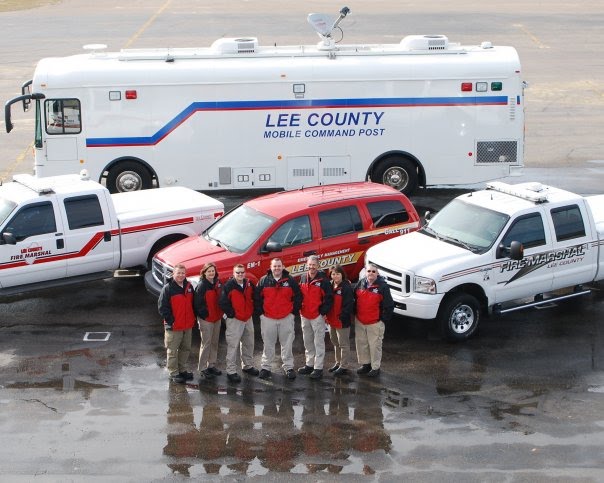
Photograph by: Billy Liggett The Sanford Herald
On Monday 1/18/2010 a vehicle accident caused a car to slam into a house at 423 Charlotte Ave.
Sanford Fire Department responded to the call finding the vehicle had severed a natural gas line and the vehicle and the house were on fire. The fire department controlled the fire until the gas company arrived to cut the gas off. There were only minor injuries with the accident.


Rockler Companies Recalls LED Light Kits Due to Burn and Fire Hazards

http://www.cpsc.gov/cpscpub/prerel/prhtml10/10108.html


WASHINGTON, D.C. - The U.S. Consumer Product Safety Commission, in cooperation with the firm named below, today announced a voluntary recall of the following products. Consumers should stop using recalled products immediately unless otherwise instructed.

Name of Product: LED light kits

Units: About 2,200

Distributor: Rockler Companies Inc., of Medina, Minn.

Hazard: Defective wiring in the light kits can cause the battery pack to overheat and explode, posing a risk of burn and fire hazards to consumers.

Incidents/Injuries: None reported.

Description: This recall involves Rockler LED lights with either an interchangeable spotlight head or a magnifying head. Models included in the recall have stock numbers 26429 (spotlight or 27017 (magnifying). Stock numbers are printed on the light’s packaging.

Sold at: Rockler Woodworking and Hardware and other specialty stores nationwide from March 2009 through October 2009 for about $60.

Manufactured in: China

Remedy: Consumers should immediately stop using the recalled LED light kits and call Rockler Companies to receive a free repair kit and installation instructions.

Consumer Contact: For additional information, contact Rockler Companies at (800) 260-9663 anytime. Consumers can also write to Rockler Woodworking and Hardware at 4365 Willow Drive, Medina, Minn 55340

CPSC is still interested in receiving incident or injury reports that are either directly related to this product recall or involve a different hazard with the same product. Please tell us about it by visiting https://www.cpsc.gov/cgibin/incident.aspx

The U.S. Consumer Product Safety Commission is charged with protecting the public from unreasonable risks of serious injury or death from thousands of types of consumer products under the agency's jurisdiction. The CPSC is committed to protecting consumers and families from products that pose a fire, electrical, chemical, or mechanical hazard. The CPSC's work to ensure the safety of consumer products - such as toys, cribs, power tools, cigarette lighters, and household chemicals - contributed significantly to the decline in the rate of deaths and injuries associated with consumer products over the past 30 years.

To report a dangerous product or a product-related injury, call CPSC's Hotline at (800) 638-2772 or CPSC's teletypewriter at (301) 595-7054. To join a CPSC e-mail subscription list, please go to https://www.cpsc.gov/cpsclist.aspx. Consumers can obtain recall and general safety information by logging on to CPSC's Web site at www.cpsc.gov.


submitted by: Lee County Emergency Services DFM Mike Tatum

Friday, January 15, 2010

US&R teams deploying to Haiti for quake response - Virginia Task Force 1 and California Task Force 2 are activated following catastrophic earthquake

US&R teams deploying to Haiti for quake response - Virginia Task Force 1 and California Task Force 2 are activated following catastrophic earthquake
Pier 1 Imports Recalls Santa Tea Light Holders Due to Fire Hazard

http://www.cpsc.gov/cpscpub/prerel/prhtml10/10111.html


WASHINGTON, D.C. - The U.S. Consumer Product Safety Commission and Health Canada, in cooperation with the firm named below, today announced a voluntary recall of the following products. Consumers should stop using recalled products immediately unless otherwise instructed.

Name of Product: Ceramic Santa Tea Light Holders

Units: About 61,500 United States and 5,500 in Canada

Importer: Pier 1 Imports (U.S.), Inc., of Fort Worth, Texas

Hazard: The flame from tea lights can ignite these tea light holders, posing a fire hazard.

Incidents/Injuries: The firm has received three reports of the tea light holders burning. No injuries have been reported.

Description: The Ceramic Santa Tea Light Holder is red and white and designed in the image of Santa Claus. The tea light holder measures approximately 7-1/2 inches tall and 3-1/2 inches wide with a red metal hat and an opening in the back to place a tea light candle. SKU number 2417274 is printed on the bottom of the tea light holder.

Sold at: Pier 1 Imports in the U.S. and Canada from September 2009 through December 2009 for about $10.

Manufactured in: China

Remedy: Consumers should stop using the Ceramic Santa Tea Light Holder immediately and return it to their nearest Pier 1 Imports retail store for a full refund or merchandise credit.

Consumer Contact: For additional information, contact Pier 1 Imports at (800) 245-4595 between 8 a.m. and 7 p.m. CST Monday through Friday or visit the firm’s Web site at www.pier1.com

Note: Health Canada’s press release can be seen at: http://cpsr-rspc.hc-sc.gc.ca/PR-RP/recall-retrait-eng.jsp?re_id=943

CPSC is still interested in receiving incident or injury reports that are either directly related to this product recall or involve a different hazard with the same product. Please tell us about it by visiting https://www.cpsc.gov/cgibin/incident.aspx

The U.S. Consumer Product Safety Commission is charged with protecting the public from unreasonable risks of serious injury or death from thousands of types of consumer products under the agency's jurisdiction. The CPSC is committed to protecting consumers and families from products that pose a fire, electrical, chemical, or mechanical hazard. The CPSC's work to ensure the safety of consumer products - such as toys, cribs, power tools, cigarette lighters, and household chemicals - contributed significantly to the decline in the rate of deaths and injuries associated with consumer products over the past 30 years.

To report a dangerous product or a product-related injury, call CPSC's Hotline at (800) 638-2772 or CPSC's teletypewriter at (301) 595-7054. To join a CPSC e-mail subscription list, please go to https://www.cpsc.gov/cpsclist.aspx. Consumers can obtain recall and general safety information by logging on to CPSC's Web site at http://www.cpsc.gov/.


submitted by: Lee County Emergency Services DFM  Mike Tatum

Local Fire Departments Respond to Fully Involved Structure Fire 1.13.2010


At 2138, Tramway Fire Department, with assistance from Northwest Pocket and Lemon Springs Fire Departments responded to 1998 Blackstone Road to a reported structure fire. 

Upon arrival of fire deparments, structure was found to be fully involved.  Fire was extinguished and crews remained on scene until 0055. 

Triangle Chapter of the American Red Cross was on scene and provided assistance to the homeowner.

Officers from Lee County Emergency Services conducted an origin and cause investigation and determined that the fire was accidental in nature and was a result of an improperly discarded candle. The structure and contents were a total loss.

There’s nothing cosier than the warm glow of candlelight, but did you know that candles are one of the leading causes of fire? Your fire department asks you to please take care when using candles in your home.


Keep lit candles in sturdy holders on level surfaces and if possible, place a glass chimney or shade over it. Candles can easily be knocked over, so keep them out of the reach of children and pets, and away from anything that can burn. Be sure to extinguish candles before leaving the room or going to bed.

A message from the Lee County Emergency Services and Tramway Fire Department.
 
submitted by:
Lee County Emergency Management Coordinator, Nancy Veroni

Thursday, January 14, 2010

Haitian Earthquake Relief Fraud Alert

Please pass on:
Haiti Earthquake Scams Link

Haitian Earthquake Relief Fraud Alert

The FBI today reminds Internet users who receive appeals to donate money in the aftermath of Tuesday's earthquake in Haiti to apply a critical eye and do their due diligence before responding to those requests. Past tragedies and natural disasters have prompted individuals with criminal intent to solicit contributions purportedly for a charitable organization and/or a good cause.

Therefore, before making a donation of any kind, consumers should adhere to certain guidelines, to include the following:

* Do not respond to any unsolicited (spam) incoming e-mails, including clicking links contained within those messages.

* Be skeptical of individuals representing themselves as surviving victims or officials asking for donations via e-mail or social networking sites.

* Verify the legitimacy of nonprofit organizations by utilizing various Internet-based resources that may assist in confirming the group's existence and its nonprofit status rather than following a purported link to the site.

* Be cautious of e-mails that claim to show pictures of the disaster areas in attached files because the files may contain viruses. Only open attachments from known senders.

* Make contributions directly to known organizations rather than relying on others to make the donation on your behalf to ensure contributions are received and used for intended purposes.

* Do not give your personal or financial information to anyone who solicits contributions: Providing such information may compromise your identity and make you vulnerable to identity theft.

Training Link from The Office of State Fire Marshal

Pocket Tools Training Tools

Pocket Tools Training is all about short interesting, informative, and interactive training snippets for the fire and rescue community to watch during any free time or during shift time.
Right now the N.C. Highway Incident Safety training video and the NCRRS training video is here. Just click on ‘Pocket Tools’ in the menu above. There is also a downloadable PowerPoint titled “Tutorial: Writing the Narrative Statement for the 2009 Assistance to FFs Grant” and the “16 Firefighter Life Safety Initiatives.”

There are short 5 minute presentations on various training topics. A link from those pages lists the movies and pictures in the presentation that can be downloaded as an Instructor resource.

Check out the ‘Daily Quick Drills’ section that focuses on the fundamental basics of fire and rescue training.

This site also posts periodical articles and video commentary from Tim Bradley, Senior Deputy Commissioner of Insurance and Assistant State Fire Marshal on the ‘Training Comments’ page regarding important insights about the fire and rescue training focus in North Carolina.

Fire Destroys Landmark Home in Lee County


LEE COUNTY - A large home described on one web site as the “finest work” of a Harvard University modernist architect was destroyed by a fire Saturday in northern Lee County near the Chatham County line.

Firefighters from Northwest Pocket Fire Department responded at 14:54 to a reported alarm activation in the shop adjacent to the residence.

Upon arrival of first due engine, the garage was found to be fully involved with the residence adjacent becoming involved in the fire.

Suppression efforts were hampered by 20-25 mph winds and brutal cold.

Four alarms were transmitted for the call and included the following departments, Northwest Pocket Fire Department, West Sanford Fire Department, Tramway Fire Department, Northview Fire Department, all from Lee County, and Goldston Fire Department and Bonlee Fire Department from Chatham County.

Central Carolina Advance Life Support provided medical standby for crews in the sun freezing temperatures. American Red Cross was also on scene offering assistance.

“The house is a total loss,” said Shane Seagroves, director of Lee County Emergency Management. “So is the shop that was attached to it. When the fire department arrived, the shop was fully involved, and strong winds going west to east just blew the flames straight over to the house.”

Nobody was home when the fire began, Seagroves said, and nobody was hurt in the fire. By 7 p.m., crews were setting up a tent and began pumping heat into it so firemen could get warm while working in temperatures that dropped into the 20s after sundown.

Lee County Emergency Services assisted by the NC State Bureau of Investigation is conducting the Origin and Cause Investigation.

The multi-level home, located at 2774 North Plank Road, is owned by Edward Metcalf of Conveyor Technologies in Sanford and his wife April. The home is one of many featured at the web site, www.trianglemodernisthouses.com, on a page dedicated to architect Brian Shawcroft, an MIT and Harvard grad who was also an associate professor for the North Carolina State School of Design.

According to the site, the home was regarded “as his finest work, taking three years to build,” and according to Seagroves, is worth nearly $1 million in property value.