
Newly Minted Tropical Storm Colin...
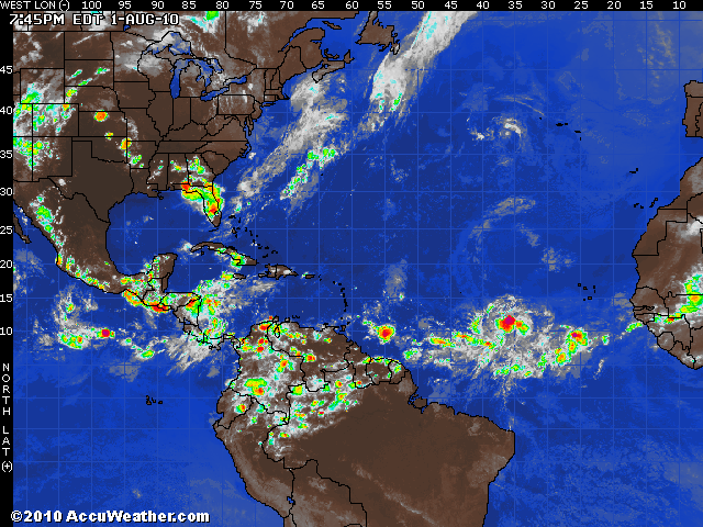
The main issue of concern this morning is with regard to newly named and rapidly moving Tropical Storm Colin (40-mph winds), some 1,300 miles east-southeast of San Juan, Puerto Rico, or 2,500 miles away from Miami, Fla. We have no significant changes to our thinking with the projected track and intensity of this system as the players on the field seem to be fairly well accounted for. A gradual strengthening trend is expected over the next couple of days as waters in the path of Colin are quite warm and wind shear remains weak. However, there are a number of mitigating factors for significant and sustained strengthening.
First, there is a considerable amount of drier air to the north of this system. In fact, this air is laden with Saharan dust from the African continent which tends to weaken convection needed to fuel tropical systems. This air mass is forecast to push westward in conjunction with Colin, and perhaps impinge on the cyclone late in the week. A second factor that should limit the intensity of Colin will be a projected increase in wind shear. An upper-level trough will push into the northeastern United States on Friday, and ahead of this trough winds will increase across the western Atlantic. Increasing winds aloft are detrimental to storm development, so this will also play a role in the eventual strength of Colin.
The aforementioned trough will also likely initiate a more northerly component to the track, and it's quite possible that this system could become caught up in the midlatitude flow and head out to sea. But these types of things are notoriously difficult to predict this far out, so it's possible that the trough misses Colin and the storm simply meanders in the waters between the Carolinas and Bermuda. All bets are off at that point... but we feel at least moderately confident that this storm should remain east of the Eastern Seaboard. Regardless, we will certainly keep an eye on the situation and update the forecast accordingly over the next several days.
Elsewhere in the Atlantic, we have one tropical wave moving into Central America, and another tropical wave in the far eastern Caribbean, but development of these features are quite unlikely at this point. Should anything more significant become likely, we'll let you know.