
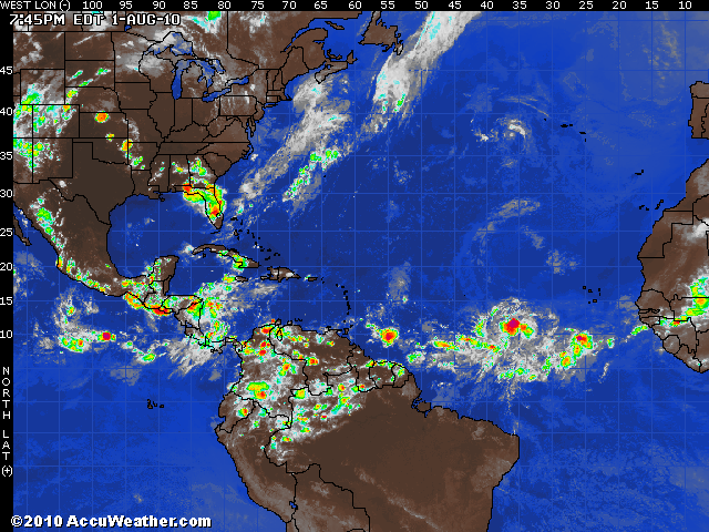
Tropical Depression Expected Soon
A developing tropical low in the eastern Atlantic is located near 37 west and 10 north and it is moving to the west at around 10 knots. Satellite loop shows that it continues to become better organized and it should strengthen into tropical depression over the next 12-24 hours. Favorable upper level wind shear and warm waters will be in the path of this feature over the next several days and it should quickly become a tropical storm and possibly a hurricane by midweek. A mid-level ridge of high pressure over the central Atlantic will steer the system to the west-northwest and it may pass close to the Virgin Islands on Thursday then take aim on the southern Bahamas late week, perhaps impacting Florida by the end of the weekend. We will have a long time to keep an eye on this feature but it is not out of the question that a hurricane could impact Florida or the Gulf coast a week to ten days from now. All interests from the central Atlantic across northern Caribbean and Bahamas into Florida and the Gulf of Mexico should keep a close eye on this developing tropical system.
No comments:
Post a Comment